Friday, August 31, 2007

Driving to Fort Steele in the rain.

After we left Lake Kootenay it really started to rain.

here we are driving down to Creston.

There is an enormous Bird Reserve here and you can walk for miles in the reed beds. We did get to the first observation post, and there were warnings about moose and bear in the area, but the rain was coming down harder and we couldn't see a thing , so we drove on.

When we got to Fort Steele the rain had stopped and the sun peeked out agin. The Campsite was right outside the heritage Town and surrounded by mountains.


Just after the sun had gone down we were treated to a spectacular lightning show. Flashes lit up the sky all around, but the storms were so far away we diddn't hear the thunder. Finally at about 11 pm The storm really hit us Sheet lightning over head thunder and torrential rain. This is when we discovered the shower skylight was leaking. Could have had a power shower in rain water!
(Our Canadian Holiday pics start on Aug 24 so scroll down if you want to see them)

The Glass House


Whilst we were on the ferry some men on a golfing trip told us about The Glass House , so we were looking out for it. The House was built in the 1950's from embalming bottles, which apparently provides good insulation.It was an interesting sight but who would want to live in a house made from embalming bottles? As we left the house it started to rain and for the rest of the day , it was very wet, however this was the only really wet day of our holiday and we spent it driving to Fort Steele. We are now 1052km (658 miles) from Vancouver.

The Glass House Aug

This unusual roadside attraction was built from over half a million discarded embalming fluid bottles. In 1952, David H. Brown retired from 35 years in the funeral business. It occurred to Mr. Brown that there should be some practical use to put the bottles to. And, it was all started, to quote Mr. Brown, "to indulge a whim of a peculiar nature".

Mr. Brown travelled western Canada collecting bottles from many of his friends in the funeral profession, until he had acquired 500,000 of the square shaped bottles, weighing 250 tons in all.

The house itself sits upon solid rock. Built in a cloverleaf pattern with three main rooms, circular shape, 48 feet in length, 24 feet wide and with the upstairs room, it contains 1,200 sq ft of floor space.

Over 320 dozen flowers border pathways and entice visitors from the terrace over a bridge also built of glass bottles. A winding path beneath the bridge leads to the rocky lakeshore and a lookout called the lighthouse which offers a spectacular view of beautiful Kootenay Lake.

Thursday, August 30, 2007

Crossing Lake Kootenay

After a day of rest it was time to start driving again. This is the ferry across kootenay Lake. it is the longest free ferry crossing in Canada and the trip takes about 35 minutes. As we waited for the ferry , the sun was shining .
Once we were on the ferry we were able to get a cup of coffee and then take photos of the lake.

During the crossing we had a sudden storm and the water became quite choppy, but by the time we reached the other side the sun was out again. However it soon became overcast and windy


Kootenay Lake is shaped like a bow and arrow, with the Main Lake (63 miles/100 km long in the North-South direction) being the bow, and the West Arm (21 miles/34 km long in a westerly and southwesterly direction from Balfour to Nelson) being the arrow. The Main Lake is broad and deep with the potential for substantial waves in a storm. The West Arm is situated entirely within the Selkirk Mountains, and is narrower and shallow, providing a more sheltered and pastoral visit, better beaches than the Main Lake, and a higher density of resorts and other facilities. Four parallel mountain ranges, running in the north-south direction, march across the southeastern BC landscape. The most westerly are the Monashees, followed by the rugged Selkirks, defined on their western flank by the Arrow Lakes, and on the east by the spectacular waters of Kootenay Lake.

Formed at an elevation of 1,736 feet (530 metres) above sea level during the Ice Ages, Kootenay Lake is fed by the Kootenay River from the south, the Duncan River from the north, and numerous creeks. The Main Lake is 5 miles (8 km) across at its widest point, with an average width of 2.5 miles (4 km).

Kaslo and the S S Moyie (Aug30)


The S S Moyie was the last Sternwheeler to regularly transport passengers on the Kootenay lake. She was built in 1898 for the Canadian Pacific Railway and steamed on the kootenay lake until 1957.She is now a tourist attraction in the little town of Kaslo. She is the oldest known surviving intact passenger Sternwheeler in the world. Hundreds of steamers similar to the Moyie worked on every river in the west from California to Alaska, Yukon and the North West Territories.She has been completely restored and is now open to the public. We spent a fascinating afternoon exploring her and Kaslo

S S Moyie (Aug30)

The paddle wheel

S S Moyie

Engine room

Steering Wheel

Detail from one of the windows in the dining room

Ladies Saloon

Gentlemans Room

Cargo deck and the Kitchen (below)

Kokanee Creek and Canyon (Aug30)


We had a pretty campsite and we decided to spend the day in the area. In the morning we walked over to the Spawning grounds because the salmon run was in progress. Lots of sock eye Salmon were trying to leap the little falls in the river. We spoke to one of the workers who was fishing the dead salmon out of the river. Some had their heads missing and this is an indication that a bear had been down to the river to feed on the dying fish.
Then we decided to take the canyon trail, following the Kokanee creek. The rcreek was strewn with big boulders and the path was rough, several times we had to scramble over the rocks. A very pleasant morning.

(Our Canadian Hol pics start Aug24 so scroll down if you wish to see them)
The salmon run in Kokanee creek

Common mergansers

Kokanee creek

Kokanne canyon

Taking a breather at Kokanee Canyon

Wednesday, August 29, 2007

Still travelling West. (


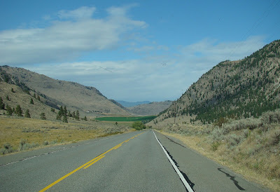
Another beautiful Sunny day after another very cold night. We are pushing on to Kootenay Lake today, but we have a leisurely start watching the resident dog eye up the chipmunks. We passed through Rock creek and on to Grand Forks The road was often steep and winding but lovely views.
After Lunch we continued to Lake Christina , a popular holiday resort as the lake has beautiful sandy beaches and shallow water safe for swimming, with deeper water further out for boating. Then we are back on the road and still climbing. At one point we stopped for a break and we could see the road bridge high above us about ten minutes drive away. Another stop at the Brilliant dam and finally we arrive at the Kokanee Campsite on Lake Kootenay. Our address here is 79 Porcupine way. The campsite is enormous but each site is shaded by trees and fairly private. Still no fire ban so it is not long before the fire is going and we are ready for a meal.
We are staying here tomorrow and will explore the area.
We are now 720km (450 miles) from Vancouver.
A Butterfly takes in the morning sun at la ponderosa campsite

The resident dog eyeballs a chipmunk but it soon darts under the wood.

Outside of Grand Forks

Time for a paddle at lake Christina

High above us we see the road bridge we are travelling towards.

Brilliant Dam

Kootenay Lake

Big Crickets/grashoppers/locusts? Over 2 inches long and very noisy! and below Killdeer

Tuesday, August 28, 2007

A Lot more Driving this Afternoon. (Aug 28)

Typical town in this area

Desert like hills and well irrigated valleys

Our Campsite for the night.

Supper cooking. it was beautiful steak


After leaving the cascades lookout we drove through the Okanagan Region for most of the afternoon.This is a very different view of Canada, much of it is desert like. The fertile valleys follow the rivers and lakes and there are many vineyards and fruit farms, all well irrigated and backed by sandy bare hills.We had hoped to camp at Osoyoos this evening but couldn't find a campsite with space and a hook up so we drove on until we found a Ranch with Campsites. It was called La Ponderosa! Hook ups , showers and fire pits, It was very high up and we knew it was going to be another cold night!
We are now 456 Km (285 miles) from Vancouver.

Morning at Manning Provincial Park BC (Aug 28)


This is an American Robin, rather different from our English ones. He was singing at the campsite. The Similkameen river ran along the edge of the campsite. it had been very cold in the night , but the sun soon came up and after breakfast we drove up to the cascade View point. The Mountains were in the mist but the views were wonderful . We made friends with the little Golden mantled squirrels in the car park and soon they were climbing all over mattie to get the Nuts and ginger cookies. We also saw our first Whiskey Jack. These Gray Jays are very tame and will eat out of your hand. We also saw The Clark's Nutcracker, with his long beak which enables hime to get the seeds from the Pine cones. We spent a couple of hours here admiring the scenery and feeding the squirrels before heading further west . We still Have a long way to go before we reach the Rockies.

Aug 28

Cascade look out The arrows show the different mountains which are mainly in the USA as we are very close to the border.

Misty Morning Mountains

Looking down to the road

The Similkameen River ran alogside the edge of the campsite.

These Little Golden mantled squirrels were very tame and were soon eating our nuts and cookies.


This is a Clark's Nutcracker. He uses that long beak to get pine seeds from the pine cones

This is a Gray Jay known locally as Whiskey Jacks they are very tame and will eat out of your hand